Ecohydrological processes along a leeward altitudinal gradient in the Sierra de las Minas, Guatemala
Researcher: Juan Carlos Rosito
Current affiliation: Universidad Rafael Landivar de Guatemala, Instituto de Agricultura, Recursos Naturales y Ambiente (IARNA), Guatemala City, Guatemala
Supervisors:
Collaborators:
- C. Tobón - Universidad Nacional de Colombia, Medellin, Colombia (soils)
- M. Mulligan - King's College London, UK(spatial environmental modelling).
- H.J. van Meerveld - VU University (hillslope and isotope hydrology)
- S. Alvarado - University of New Hampshire, Darmouth, NH USA (plant physiology)
Duration: 2009-2016
Funding: World Wildlife Fund (WWF) and IARNA
Background and research questions
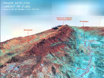
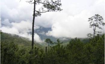
The Sierra de Las Minas Biosphere Reserve (RBSM) in eastern Guatemala contains ca. 60% of Guatemala's remaining cloud forest and is home to at least 885 species of birds, mammals, amphibians and reptiles.
The mountain range runs more or less parallel to the prevailing trade-winds (NE), with altitudes ranging from 150 m to more than 3000 m asl.
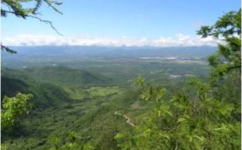
As a result, there is a pronounced climatic gradient, particularly on the drier southern, leeward side, where dry forest at low elevations gives way to mixed oak-pine formations at intermediate elevations, followed by montane cloud forests above 2000 m.
A total of 63 rivers originate in the Reserve providing water to the adjacent Polochic and Motagua valleys. In support of a regional (Fondo del Agua) and several local 'payment for environmental services' (PES) schemes aiming to preserve the (cloud) forest, spatially discrete data are required on the ecohydrological functioning and relative importance of the respective vegetation zones.
This leads to the following key research questions:
- How do rainfall patterns, occurrence and capture of 'occult' precipitation, throughfall, and soil water dynamics (infiltration, uptake) differ between leeward and windward cloud forests?
- How much of the deep soil water stores present in leeward cloud forest, pine-oak forest, and dry forest - and consequently how much of the dry-season baseflows - are linked to cold fronts occurring in winter and spring?
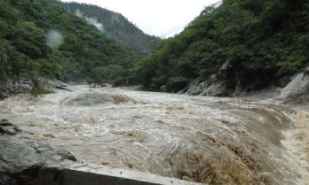
- How do the water budgets of the three major leeward ecosystems vary with elevation? And what is the regulating role of each during extreme rainfall and in the dry season?
- How are the regulatory services of the respective forests affected by changes in the intensity and frequency of ENSO events (both the warm (El Niño) and the cold phase (La Niña))?
Project publications
- Rosito, J.; Pérez, G.; Gándara, A.; Maas, R. y Gálvez, J. (2012). Bases para el seguimiento y evaluación del cambio climático en los ecosistemas de Guatemala. En Capiacute;tulo 5, Perfil Ambiental de Guatemala 2010-2012. En IARNA-URL (Instituto de Agricultura, Recursos Naturales y Ambiente de la Universidad Rafael Landívar). Guatemala.
- Rosito, J. (2012). Definición de servicios hidrológicos e impacto de los procesos de gestión de WWF-CARE. IARNA-URL/WWF. (Instituto de Agricultura, Recursos Naturales y Ambiente de la Universidad Rafael Landîvar). In press.
- Rosito, J. (2012). Protocolo de mediciones climóticas, hidrológicas y de erosión: estudio de caso en la cuenca Teculutón. IARNA-URL/WWF. (Instituto de Agricultura, Recursos Naturales y Ambiente de la Universidad Rafael Landiacute;var). In press.
- Rosito, J. (2010). Anólisis e integración de información hidrológica y climática en la cuenca Teculután, Zacapa Guatemala para el año hidrológico 2009-2010 (muy seco) . Proyecto Pago Equitativo de Servicios Hidrológicos (PESH) IARNA-URL/WWF-CARE. IARNA-URL. (Instituto de Agricultura, Recursos Naturales y Ambiente de la Universidad Rafael Landiacute;var). Technical Report.
- Rosito, J. (2010). Sistematización de información ecohidrológica de la Reserva de la biosfera Sierra de las Minas, Technical Report.


